Hi,
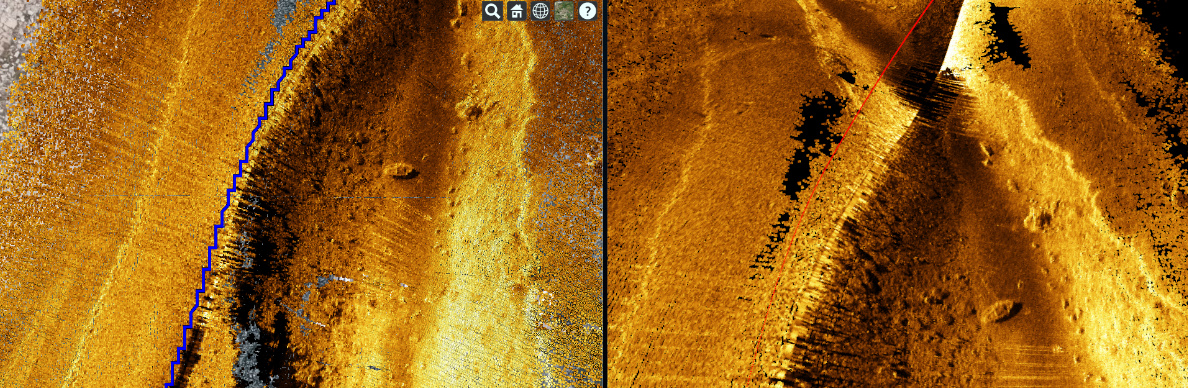
We are trying to overlay a track line of the path taken by our sonar collection vehicle during an underwater survey on the point cloud so acquired. Attached please see the image. The left image shows the blue track line over the gold yellow point cloud on a basemap. However, the trackline is too jaggy. On the right the same point cloud and track line is shown in red using our own internal viz tools. The red track line is pretty smooth. Something is going on with the blue track line?
The code uses the following block:
var tracklineentity = viewer.entities.add({ polyline: { positions: Cesium.Cartesian3.fromDegreesArrayHeights(trackline), width: 5, material: Cesium.Color.BLUE, }, });
where trackline is an array of lat / long coordinates converted from the original UTM coords.
trackline = [-97.95552,30.45297,205,-97.95552,30.45297,205 ... ]
Kindly inform how to reduce the jaggedness of the blue track line?
Cesium JS version is 1.69.
Thanks for your time.
Sincerely,
QIqbal