Hello,
When using pickPosition (Scene - Cesium Documentation) to generate a point cloud, the exported point cloud shows some strange artifacts both on Cesium World Terrain as well as imported assets (such as OBJ files). It appears as if the height coordinates are sometimes inaccurate. To show a basic example, we have rendered some houses on top of the cesium world terrain (green surface):
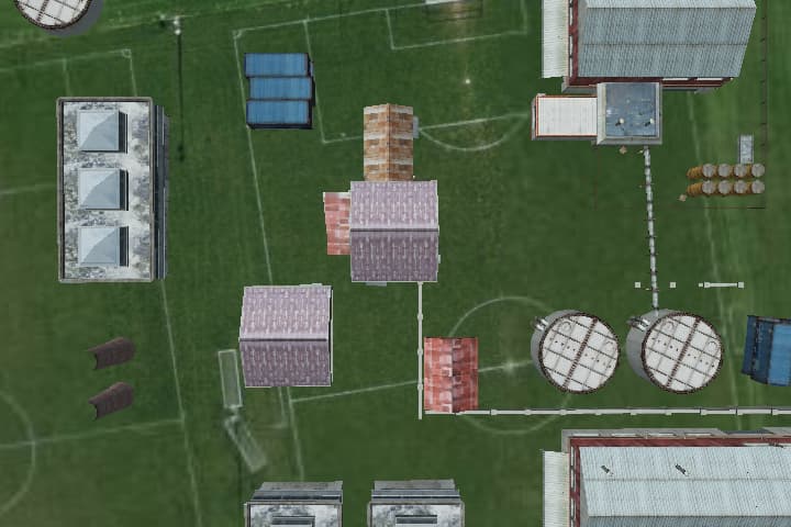

Upon closer inspection, as you can see in the attached images, the cesium world terrain, which should be a single surface, consists of overlapping tiles:

The tiles are also visible within the roofs of the buildings.
-
Is there a common explanation for this behavior and is it possible that this is caused by the pickPosition function?
-
Is there a workaround or alternative functions that could eliminate or reduce these artifacts?
Thank you for your help.
Context: We are using CesiumJS to generate a dataset of RGB images with corresponding scene coordinates (x,y,z) for each pixel of the RGB images.