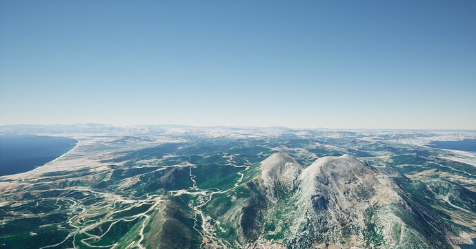
hello guys is there a way to turn flat terrains like morocco into 3d terrrain ?
could Cesium World Terrain+ higher-resolution DEM " premium version “ turn it into 3d if yes plz tell me how and thanks
It seems like there’s a few questions here:
-
Is there a way to turn flat terrains like Morocco into 3D terrain?
I’m not sure what you mean by this as, to my eye, the terrain in Morocco is very much not flat in Cesium World Terrain: -
Does Copernicus DEM cover Africa?
Copernicus has worldwide coverage in 30 meter and 90 meter resolution, but the 10 meter resolution that I think you’re referring to as the “premium version” only covers Europe, not Africa. You may be able to find other datasets with 10m resolution (or better!) that cover Morocco. -
Can you turn a DEM into 3D terrain?
The DEM format is supported by Cesium ion. You should be able to upload it as an asset and it will be tiled and made available in the quantized mesh format, same as that which is used by Cesium World Terrain.
Thank you for your answer
In my experience when working with a city in Morocco the buildings are flat.
So yeah maybe if i found other datasets with 10m resolution or better that will turn the buildings into more polished 3d if that’s the only solution you know thank you i will look for more datasets if there’s other solutions i will be happy to know more.
