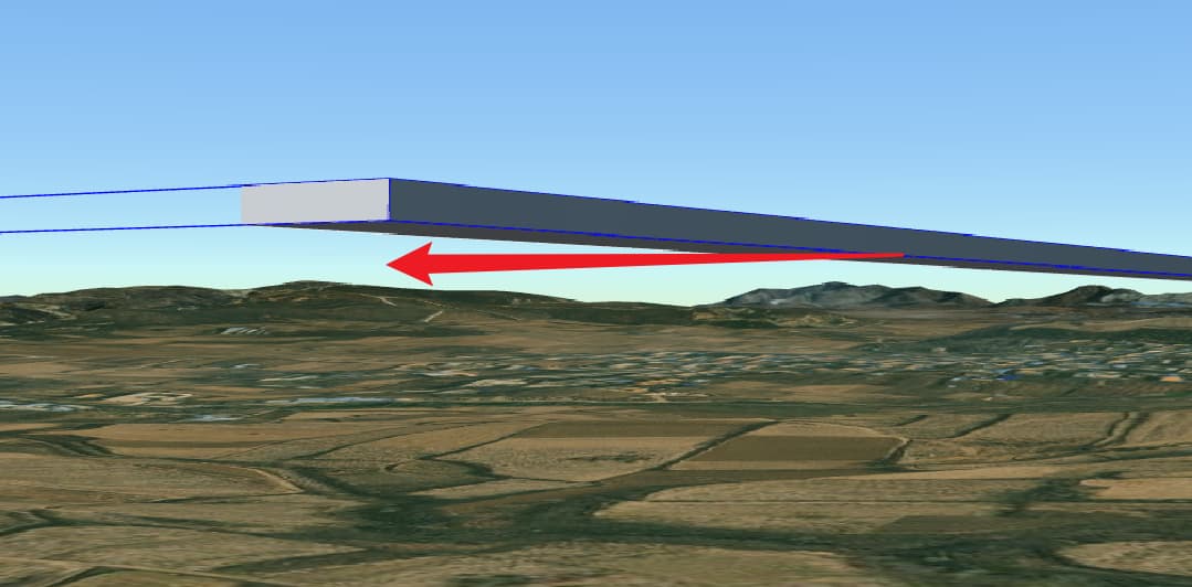
I am loading a long-distance road, but both ends cannot align with the Earth’s surface. What should I do to handle this? the road is based on WGS84 Coordinate System.
Here is my tileset.json:
{
    "asset": {
        "version": "1.0",
        "tilesetVersion": "TilesetPublisher.0.2.10.1",
        "extras": {
            "iTwinMaterials": [
                {
                    "id": "0",
                    "name": ""
                }
            ]
        }
    },
    "root": {
        "refine": "REPLACE",
        "geometricError": 4096.003125,
        "boundingVolume": {
            "box": [
                0,
                0,
                0,
                65536.05,
                0,
                0,
                0,
                65536.05,
                0,
                0,
                0,
                65536.05
            ]
        },
        "content": {
            "uri": "17-1-0.glb",
            "boundingVolume": {
                "box": [
                    0.05000000000291038,
                    13610.272441670488,
                    0.050250000002908024,
                    50000,
                    0,
                    0,
                    0,
                    13731.963507338893,
                    0,
                    0,
                    0,
                    25
                ]
            }
        },
        "transform": [
            -0.8957849056459963,
            -0.4441837687045336,
            0.008893873076885939,
            0,
            0.2868724116124213,
            -0.5630187867209315,
            0.7749341991730035,
            0,
            -0.3392705988163694,
            0.696858911931182,
            0.6318885326075094,
            0,
            -2166820.3211563453,
            4450631.669410935,
            4008667.8501060717,
            1
        ]
    }
}
snapshot: