Hello, I am Connor Jakubik, lead software engineer at SimDynamX. We develop the realtime space simulation software Space Teams Pro (GitHub - SimDynamX/SpaceTeamsPro: Public technical user documentation, discussions, and bug tracking for Space Teams Pro.), which includes our own dynamic LOD planet rendering code. Users of Space Teams Pro include NASA and other engineering companies.
I don’t know if this was specific to the reveal video, but it seems to me that the lunar terrain displayed in the video is at 2x the real vertical scale for the altimetry. If the LRO LOLA DEM 118m dataset (https://astrogeology.usgs.gov/search/map/moon_lro_lola_dem_118m) is being used, there is a 0.5x scale factor embedded in the metadata to bring the increments for the int16 data values down to 0.5m increments. This is easy to miss when directly reading the data through a tool like GDAL. The validity of the values can be checked by comparing min and max altitude in the dataset to expected values.
Please follow up with us if you’re interested in cross-validating Cesium with our planet rendering: connor@simdynamx.com
Yeah I noticed the same issue, it’s not just a problem in the video, it’s also apparent when looking at the tileset directly in this cesium story:
https://ion.cesium.com/stories/viewer/?id=b23dc283-55a7-4acc-ae02-c3ef152c7bf4
Here is a comparison between the Cesium tiles and Lunar Quickmap (https://quickmap.lroc.asu.edu):
According to the data sources here they are using a different dataset for the terrain model. At the same time I don’t think the data sources are correct, as they imply that a shaded relief was used for the terrain model which is impossible.
1 Like
Hi @connorjak
Thanks for the feedback. As you stated, the reference to the shaded relief was indeed a typo.
As you mentioned, the actual source is the related DEM - (Astropedia - Moon LRO LOLA - SELENE Kaguya TC DEM Merge 60N60S 59m). We will update our reference information accordingly.
Our processing pipeline is aware of the scale but we are investigating if there was an error on our side.
If you could provide the location and expected height(s) you referenced. It would help us investigate our tiling pipeline.
Shackleton Crater Rim (near connecting ridge)
Apollo 17 landing site, directly on top of descent stage
Apollo 15 landing site area
Hi @Dave_Braig
Attached are several screenshots from Space Teams, all with a camera within ~1 meter of the surface. The latitude/longitude/altitude is in the bottom left corner, and I also give 3D location in Moon body-fixed frame. Moon ME frame (https://www.janss.kr/archive/view_article?pid=jass-38-3-185#:~:text=The%20first%20one%20is%20called,the%20Moon%20(Archinal%20et%20al.) is being used as the moon body-fixed frame. The reference “sea level” for the altitude is 1737400 m.
Since I’m a new user I’m limited in number of images; I’ll split this across multiple messages.
DEMs in use:
- Lunar_LRO_LOLA_Global_LDEM_118m_Mar2014 (should have good agreement with the SELENE Kaguya TC DEM)
- LRO_LOLA_DEM_SPole75_30m
- LRO_LOLA_DEM_SPolar875_10m
- APOLLO17_DTM_150CM
- LRO_NAC_DEM_Apollo_15_26N004E_150cmp
- LDEM_Site01-Site-04_upscale_craters (custom additional detail, doesn’t change altimetry by more than ±2 meters)
Using gdalinfo -mm on Lunar_LRO_LOLA_Global_LDEM_118m_Mar2014:
Band 1 Block=92160x1 Type=Int16, ColorInterp=Gray
Computed Min/Max=-18257.000,21563.000
NoData Value=-32768
Offset: 0, Scale:0.5
So -9128.5 m and +10781.5 m are the min and max of the dataset, which match the info in other places online.
I hope this helps!
Thanks @connorjak I appreciate the additional information that you have provided this helps us in our investigation.
@connorjak I want to thank you for being such an eagle with the data, and also reaching out with your findings. We did in fact discover that the scaling for the data was not accounted for properly during the initial tiling. We have re-processed and updated the dataset with the correct scaling parameters.
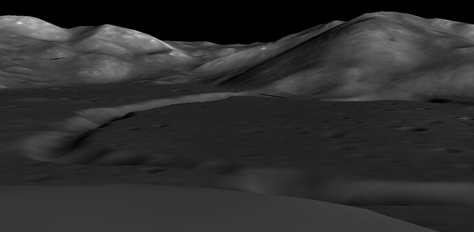
For comparison, I captured a screen shot viewing the same approximately location from the Apollo 15 landing site you shared above:
And @semeion here is a overview of the Apollo15 landing site in the CesiumJS sandcastle
Thanks again for bringing this to our attention!!
2 Likes


