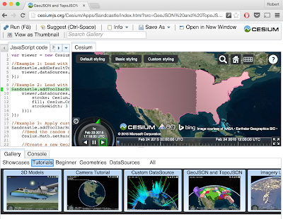
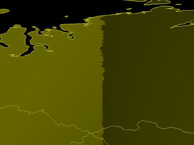
I’m new to Cesium so I apologize if this has already been discussed. I’ve noticed a polygon display issue that only affects 2D mode, not 3D or Columbus. If you view the Sandcastle GeoJSON and TopoJSON example in 2D mode, there is a jagged edge that runs through Longitude -90 and what appears to be a shading affect applied to the polygon’s fill. This is apparent with both default and basic polygon styling, but is not present with custom styling.
I’m using Cesium to create a world map from TopoJSON for all country borders, and I’ve noticed the same issue occurs on the opposite side of the world, at Longitude 90.
Is there a workaround or can someone point me to the API documentation for disabling shading effects? Thanks.


