Does anyone know, why whether Stamen Tiles (OSM) for terrain are supported ? at least this code is not working for me :
var imageryProvider = new Cesium.OpenStreetMapImageryProvider({
url: ‘http://tile.stamen.com/terrain’,
fileExtension: ‘jpg’
});
however with urls:
**http://tile.stamen.com/watercolor** http://tile.stamen.com/toner
it works fine.
Hi,
That layer (sort of) works for me using this code in Sandcatle:
require([‘Cesium’], function(Cesium) {
“use strict”;
var widget = new Cesium.CesiumWidget(‘cesiumContainer’, {
imageryProvider : new Cesium.OpenStreetMapImageryProvider({
url : ‘http://tile.stamen.com/terrain’,
fileExtension : ‘jpg’
})
});
Sandcastle.finishedLoading();
});
However, the Stamen service returns gray tiles for the first four tile levels, for unknown reasons, so you’ll have to zoom in before you can see anything. You can see the problem in their client as well:
http://maps.stamen.com/terrain/#3/36.88/-111.82
Zoom in and suddenly you’re looking at the U.S. You’ll probably need to contact Stamen to ask them why their layer is behaving that way.
Kevin
Unfortunatelly, the code you posted, does not work either in the SandCastle. There are no images, no matter what zoom level I have. In the console I receive the message:
An error occurred in “OpenStreetMapImageryProvider”: Failed to obtain image tile X: 1 Y: 0 Level: 1.
and the Earth is a transparent image in all zoom levels…
Marcin
Hi Marcin,
I started with the Black Marble example. It’s still working for me (though I do get some errors in the console about missing tiles). The globe is initially grey, and if I zoom in from the default view without rotating, the U.S. eventually appears:
Does the Stamen client I linked above work for you?
Kevin
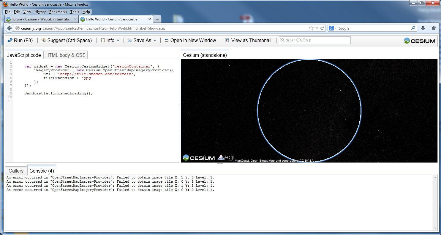
This is what I get from SandCaste:

Can you load the tiles directly in your browser?
http://tile.stamen.com/terrain/4/3/5.jpg
